Drone Ag has announced its Skippy Scout drone app can now interpret almost any form of map.
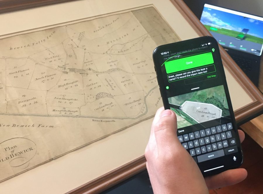
Farmers can import a map or even take a picture of one that is printed out and the software will interpret the field shape. Drone Ag founder Jack Wrangham points out that any map can be used to take leaf level image of a crop with just a drone and a phone.
The app can work with existing satellite, digital and printed maps so users can choose which fields to monitor, it also has the ability to store fields to repeat crop walking or scouting with a drone.
“You don’t need a license to use drones under 250 grams and the farmer doesn’t have to fly the drone. Skippy will automatically convert any map so the user can choose points for the drone to fly to,” explains Mr Wrangham. “The drone flies to the points and sends images back to the phone for the farmer to view.”
So what about the cost. The subscription starts at £30/month for a single user and Mr Wrangham says something as low-cost as a £369 Mavic Mini drone is suitable, meaning an overall cost of £800 for the first year.
The mapping ability will be added to the Skippy Scout app that was launched just two months ago. Development is ongoing and the firm is finalising an automatic image analysis feature that will offer GAI, weed coverage percentages as well as an unhealthy leaf percentage.