By studying old plans and combining this information with aerial image analysis and drainage detection, Apus Systems is able to create digital drainage maps.
KEEPING IT BRIEF
- Drainage maps can date back 100 years or more.
- The images and data can be collected by users themselves.
- The app is used to view the plans and manage drain maintenance.
Apus Systems’s drainage detection tool becomes particularly useful when land changes ownership or is passed on to the next generation. These are typical moments when a great deal of first-hand knowledge, such as the location of the field drains, can be lost. If you do happen to find the existing plans, they may be up to 150 years old, inaccurate, or else no longer reflect the actual real-life drainage systems.
Four paths, one goal
To create a digital drainage map record, the team at Apus Systems collects various bits of information and data. First up, there are the old drainage plans (if available), which are then fully digitised and processed. Any hands-on information from farmers or staff is also incorporated at this point.
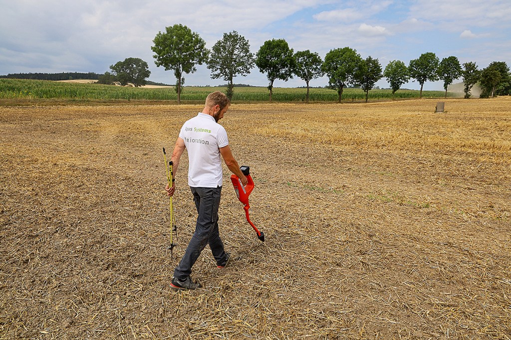
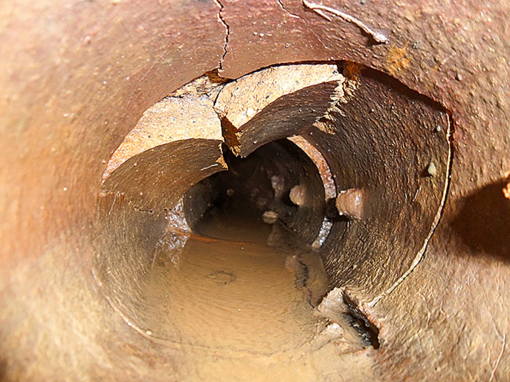
The second step is detection. For this, they use a special copper pipe that is inserted into the drainage pipes. The copper can be easily located above ground with a detector. The pipework is then plotted and marked with rods. But it is not just the location, as the detector also shows how deep the pipe is. Apus then measures the marked points with an RTK receiver and records the layout using a connected tablet.
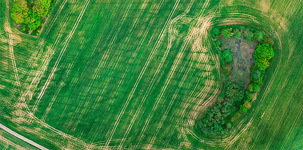
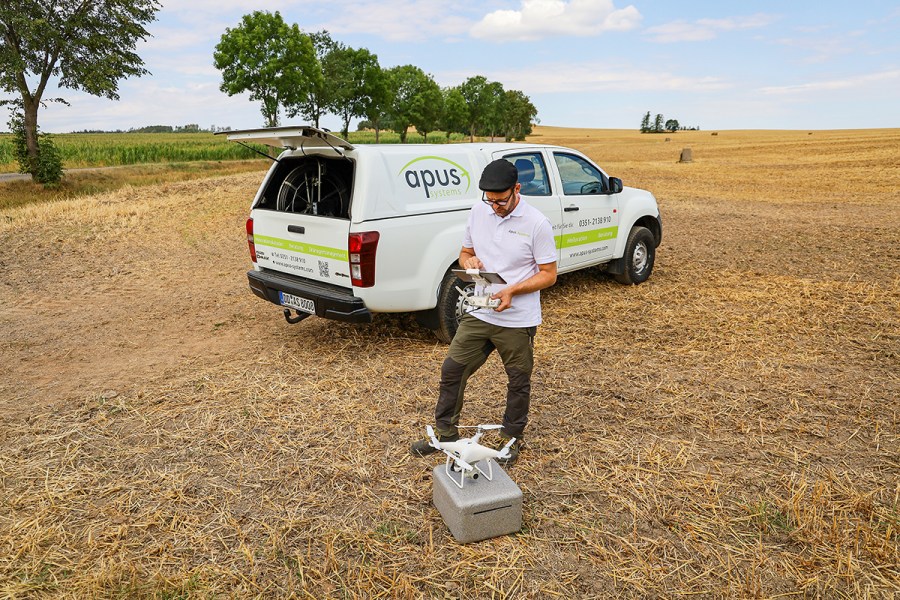
For the third step, a GPS-controlled drone flies over the area at a height of 120 metres, following a programmed route and also photographing the entire surface. Later on, software then stitches these images into one large image and calculates a terrain model. The course of the drainage pipes can then be traced and marked out by different colour shades and crop growth heights.
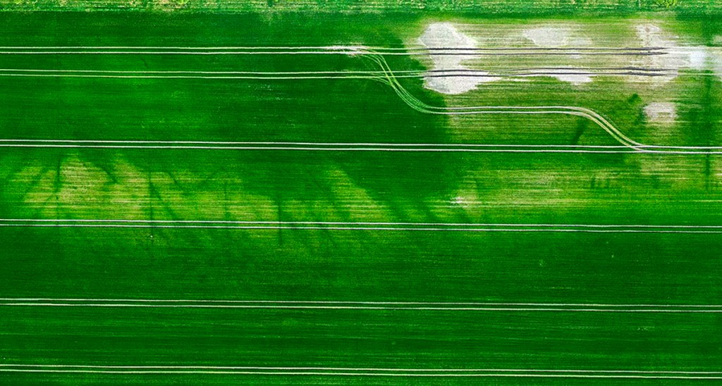
The best indicator for this is a cereal crop at the time of germination. But aerial images can also show drains in uncultivated fields. In a fourth step, you can guide a camera along the lines in order to detect and record any damage or contamination. This makes it possible to detect and mark areas in need of repair.
If you wish to record your own data, you can buy the Apus equipment and then send the data to the firm for further processing.
Drainage management via app
Once all the data is collected and processed, the digital map is available in the company’s own Melioration24 app. With the help of this app, farm managers and owners can optimise their drainage management.
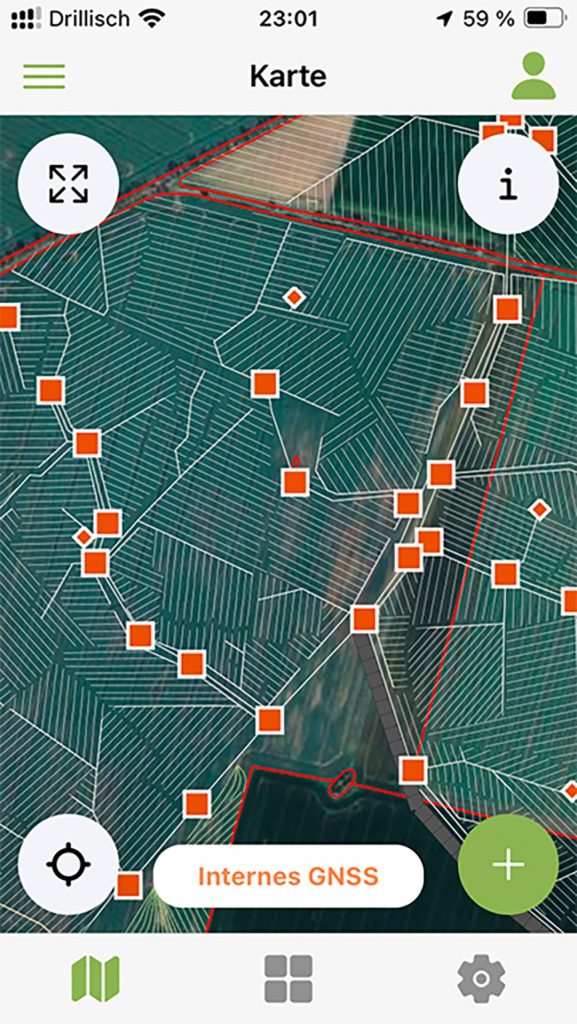
For example, the cleaning intervals can be stored for each field — or even for each drainage line. The app will then prompt a reminder at the set interval. It also allows you to create jobs for specific lines and then hand it over to staff or a contractor to carry it out. Any maintenance or repair work can be logged in real time and on the move —practical, because your staff or contractor has all the information about your drainage in their pocket, provided they have user permission. In this way, the drainage stays ‘in good shape’. The app is currently being optimised by the Melioration24 research project in Thuringia.
Summary
The software from Apus Systems facilitates drainage management on farms by digitising all of the older paper plans. The app makes the entire drainage management process convenient and logs any work carried out.
Apus Systems
The service and consulting company Apus Systems was founded in 2012. The Dresden-based firm specialises in drainage detection, the creation of digital drainage schemes and consultancy. The team of three will visit customers in all of Germany and recently carried out its first orders abroad.
The customers are farmers and companies that supervise construction projects on agricultural land and who want to avoid damaging existing drainage systems when building solar parks or laying cables for wind turbines, for example. Up to now, Apus Systems has digitised around 30,000km of drainage pipes covering 100,000ha. They consult and educate farm managers and teach young farmers at vocational schools.
“Far too little attention is paid to land improvement in vocational schools today. In the past, it was a separate subject. As farms pass on to the next generation, a lot of expertise in draining is being lost,” says Mario Hehne. In order to stay innovative, the company participates in research projects. The company is currently working not only on the Melioration24 project in Thuringia, through which the app is currently being further developed, but also on the ratiogeo project. The aim here is to reduce nitrogen emissions from drained areas using SQUID technology (Superconducting Quantum Interference Detectors).
Sebastian Rüther
For more up-to-date farming news click here and subscribe now to profi and save.