

CHCNAV has not just updated its auto-steer hardware; the software has also been improved with more functions that are easier to use. We take a closer look.
KEEPING IT BRIEF
- With the latest CHCNAV steering system you can set up an A-B line along the field boundary or diagonally to the seed rows.
- Saved guidance lines and field boundaries can be shared with other users via the cloud.
- The software update is free and can also be installed on the NX510.
Attractive pack pricing has helped CHCNAV to become one of the rising stars in the retrofit auto-steer market. Now it is coming out with its next generation of retrofit systems, and, as we witnessed at Agritechnica back in November, it’s looking to grow its precision farming line-up way beyond just steering a tractor from A to B.
Replacing the NX510 are the NX610 and NX612 units. Note that the Android-based displays being used for the new generation screens are 10-inch and 12-inch. But there is no actual difference in the amount of information being shown between the 610 and 612 systems.
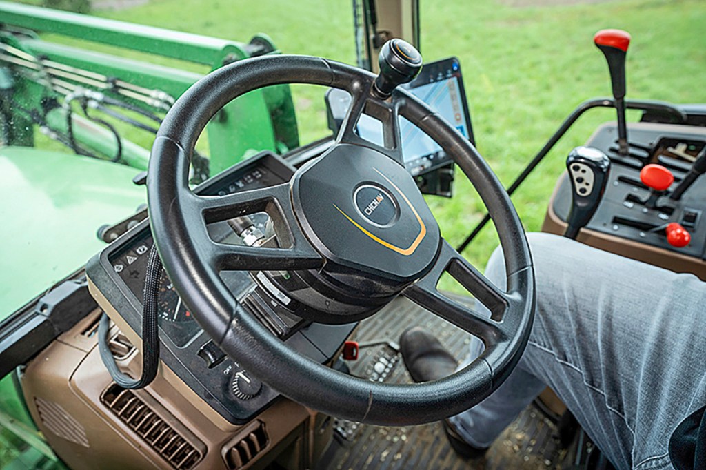
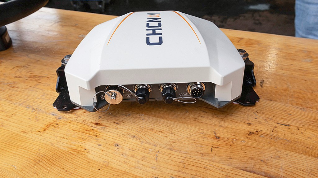
Other key hardware changes include the flatter motorised steering wheel and more interfaces and connection options for the GNSS receiver that comes with the system.
As part of the model update, CHCNAV has completely redesigned the main operating software following feedback from users, so it now has a much more operator-friendly menu structure.
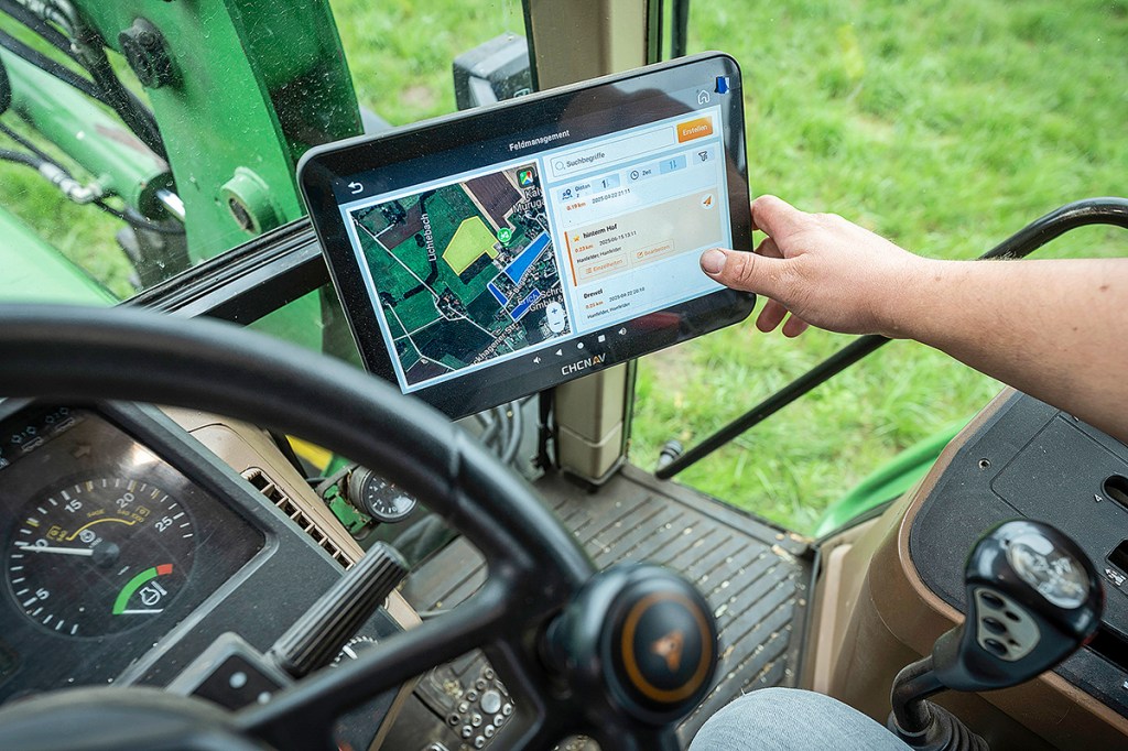
With the new AgNav 5.0 software, users can quickly return to the main view from any submenu by hitting the home button. The main view now features a handy 3D perspective. Creating new machines and new fields is possible with fewer clicks than in the previous version. If field boundaries have already been entered on the system, the new software automatically recognises the field as soon as the tractor enters.
Another nice touch is how the fields and tracks are shown on Google Maps satellite view.
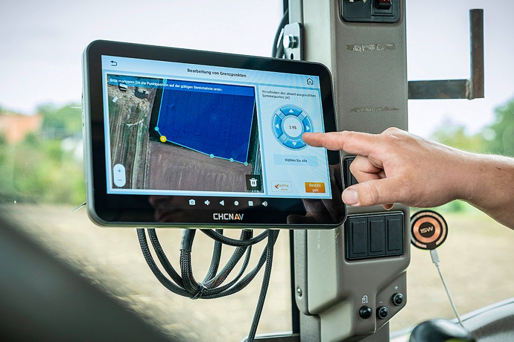
Editing boundary points
Field boundaries can either be imported or recorded driving around the field. You can also edit the recorded boundary by either deleting, adding or moving points in the boundary line on the screen.
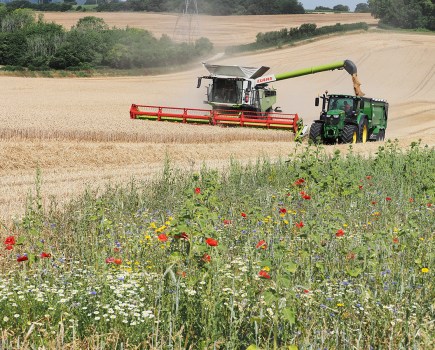
Users can also create various boundaries for one field. For example, it makes sense to nudge the boundary line if a wildflower strip has been planted along part of the field and you don’t want to include this part of the field in the area that you are about to cultivate.
Another very useful feature is that you can create the auto steer line by utilising the boundary points. In this case, the system shifts the reference line automatically to half the working width of the mounted implement — provided, that is, the machine’s working width etc. has been saved on the system and the operator has selected the implement.
Using the boundary line as the reference track works in much the same way for curve mode: you simply set the A and B points on the boundary line. This means you no longer have to focus on creating the reference line as you are recording the boundary.
Another useful operator function is that you can pause the guide line recording in curve mode when on a straight section of the field. The CHCNAV system automatically connects the recorded sections until the operator sets point B.
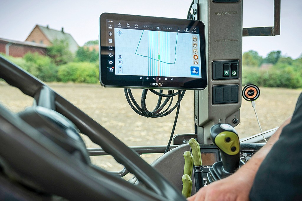
For jobs like cultivating stubble, where you might want to drive at a slight angle to the way the field was drilled, you can now do this, too. Just select the first point on one end of the field and select a second point at the other end and the system creates the A-B line for you to follow.
Spacings and rhythm
Also new for CHCNAV is that the steering system can adapt the line spacing to the width of the field, automatically dividing the field width by the implement’s working width … even if this means creating a little bit of overlap so you don’t end up with a half-width or narrow strip that might cause a problem — for instance, when mowing silage or using a combine and you don’t want to catch the swath.
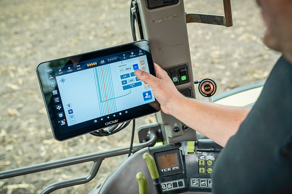
Once the steering system is activated, the screen displays the parallel waylines. A new neat feature is that you can also view the tramlines. That’s assuming, of course, you entered a tramline control rhythm in the way line settings — for example every fifth, sixth or seventh pass.
Vegetable growers can also set variable rhythms — for example, a crop irrigation tramline after 50m, then a veg bed with tramlines, then another irrigation tramline and so on.
Easier headland turns
CHCNAV has also improved the automatic Auto-U-Turn feature. Previously this was linked to the position of the A and B points, which the operator saved when creating the reference line. Since accurately storing these points was tricky, the auto-headland turn feature wasn’t widely used.
In the new AgNav version, the automatic turning is now based on the width of the headland. In the Auto-U-Turn menu, the operator sets the distance the outfit should keep from the boundary when turning and the number of passes the combination can skip each time. The actual turn path itself can also be specified. Depending on the shape of the field, it may make sense for the tractor to swing more to one side when making the turn. In that case, the turning path is no longer symmetrical.
Working as a team
You can also document the work that is carried out when using the auto-steer, even choosing the colour for the coverage map. And that’s not all — the lines in the coverage map can be reused as reference lines for the next field operations. The tractor will then automatically follow all the lines that were recorded during the first pass. This may be of interest in viticulture, where rows are not always spaced identically.
Courtesy of a cloud connection using the mobile phone network, tracks and field boundaries can also be shared with other CHCNAV steering systems in the team or on the fleet.
Other points worth mentioning
- CHCNAV tablets are ISObus-compatible and can control up to 255 sections via Section Control.
- The display shows the compass direction of the tracks. This information is helpful when sharing the reference line with other machines.
- Manually moved reference tracks can be returned to their original position with a tap of a button.
- Steering sensitivity can be easily adjusted to the soil conditions. CHCNAV has pre-set profiles for light and heavy soils to best match the tractor’s steering behaviour.
Summary
As for prices the 10-inch NX610 complete with motorised steering wheel will set you back €5,500 or £4,750 with a 12 month RTK subscription as a fit-yourself kit (prices shown supplied by CHCNAV Irish distributor J Leech Agri and UK dealer ERH Services).
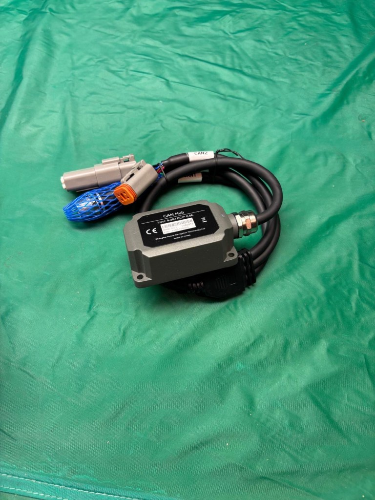
There is also the option to connect the NX unit with a CANBus nav controller on steer- ready tractors instead of using the steering wheel motor. The price will be similar.
Anja Böhrnsen
For more up-to-date farming news click here and subscribe now to profi and save.