
Sam Dimension is taking a different approach to other mapping-system suppliers for spot spraying, banking on high-tech kit run by contractors.
KEEPING IT BRIEF
- Sam Dimension’s system uses six cameras to take high-resolution photos at greater altitude than other drone-based systems.
- The farmer gets an application map for the sprayer plus a report from the contractor.
- The complete system, including the Multicopter drone and spare batteries, costs about €90,000 (about £77,000)
Founded in 2020 as a start-up from the University of Hohenheim, Sam Dimension specialises in precision farming and has developed a camera system for mapping weeds by drone.
The Sam-Cam AI is a multi-camera rig. Fitted with six 80mm lenses, it takes six 20MP RGB photos simultaneously every 0.8 seconds. “That gives us a working width of about 48m at a flying height of 60m. On top of that, thanks to our special lens arrangement, we can save about 80% on data volume compared with standard photogrammetry,” says managing director, Robin Mink.
The graphics processor built into the multi-camera rig also pre-processes the images during the flight itself to cut down the data volume.
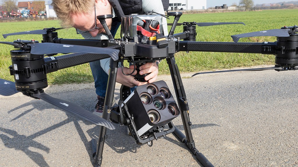
High resolution from a 60m flying height
According to the manufacturer, photos taken with the Sam-Cam AI from a flying height of 60m have a high image resolution with a pixel size of 1.6 x 1.6mm. Other camera drones have to fly very low over the crop to achieve that.
Apart from the reduced output achievable at lesser altitude, Robin Mink suggests that the lower the flying height the more obliquely the cameras look into the crop. As a result, there is a higher risk of crop leaves hiding small weed leaves, a risk that decreases when taking photos at a steeper viewing angle. This explains why the outward-facing cameras on Sam Dimension’s multi-camera rig ‘look’ down into the crop at a steep angle from 60m up. This angle is 70° at least, says the manufacturer.
Due to its high image resolution, Sam Dimension’s AI-based image analysis is reckoned to tell weeds from crop plants at a very early growth stage. Robin points out, “It detects sugar beet, for example, by its cotyledons, and allows users to distinguish between the crop plants and dicotyledonous weeds such as black bindweed as early as at the cotyledon stage.”
Needs a load carrier
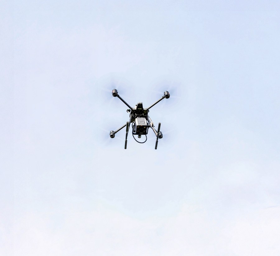
The multi-camera rig weighs about 5kg, so it needs a drone with the payload capacity to carry it. Sam Dimension sources the drones from various German drone manufacturers such as Multikopter.
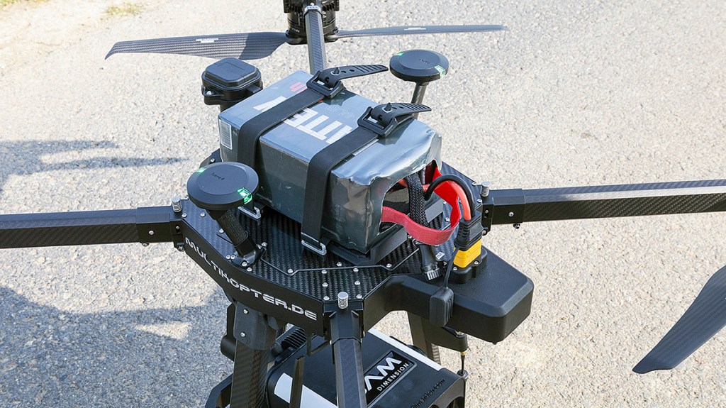
The multi-camera rig is suspended on a gimbal and attached to the belly of the Multicopter with a bayonet mount. It receives data from the RTK-GNSS receivers and takes power from the drone’s battery via a lead. The Multicopter’s receivers supply the positioning data for georeferencing the photos. Sam Dimension uses the Sapos correction service to correct the GNSS data, for which a mobile modem with a SIM card is housed in the drone’s casing.
As the Multicopter drone also uses its three RTK-GNSS receivers to determine its current attitude (roll, pitch, yaw), it doesn’t need an attitude sensor or magnetic compass for navigation. To determine its accurate flying height, it is equipped with a lidar sensor.
Logisticsogistics in mind
Flying the 25kg drone and running the electronics in the multi-camera rig takes energy and thus impacts on flying time before the battery needs charging. “Image pre-processing costs about two minutes of flying time,” is Robin Mink’s experience.
The drone’s battery has a capacity of 30Ah, which is good for about 30 minutes of flying time while mapping. At a velocity of 5m/sec (18km/hr), the drone covers about 1ha/min.
To avoid the incidence of the drone abandoning its mission part-way through a large field due to lack of power, Sam Dimension plans each mission by initially dividing the field into sections. In-house developed flight planning software factors in the battery life to ensure the drone can finish a specific section. After every section, it automatically flies back to the landing site for a battery swap. The site is set up in a logistically sensible location that is easy to reach and close by.
Should the battery charge not last through a job despite this forward planning, the Multicopter drone’s fail-safe function kicks in, which aborts the current job and flies the drone safely to the landing site.
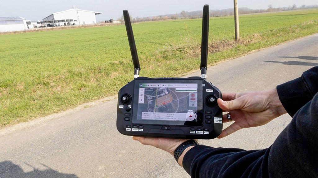
Sam Dimension operates a web-based portal, from where a dispatcher can assign flight jobs to various drones. The drone’s remote control then syncs with the Sam-Gate portal and downloads the relevant flight plans automatically to the SIM card in the remote control.
From a list of field names, the pilot then picks the relevant flight plan which comes with a Google Maps link and shows the route and the starting point. The pilot taps the starting point in the portal view on his mobile phone, Google Maps opens and navigating begins. Once a job is completed, it can also be ticked off in the smartphone view, so the office is informed immediately.
24 hours to the map
The multi-camera rig stores the photos on an SSD with 1 terabyte of storage capacity – enough for a full day’s flying covering up to 550ha. To upload and process the photos, the pilot connects the drive to a laptop or PC.
Field Commander, a tool Sam Dimension developed for uploading the image data, opens up. The upload program shows the list of flights stored on the SSD and is operated via just one button: ‘Process and Upload’. Once the upload and data processing are completed, the spot-spray map – which Sam Dimension generates in the background from the uploaded photos – is ready for download. However, Sam Dimension does not produce an orthophoto (corrected aerial background image) of the entire field for viewing at the portal.
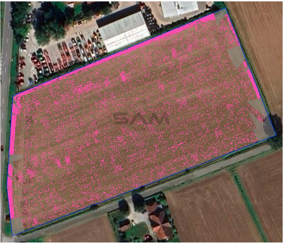
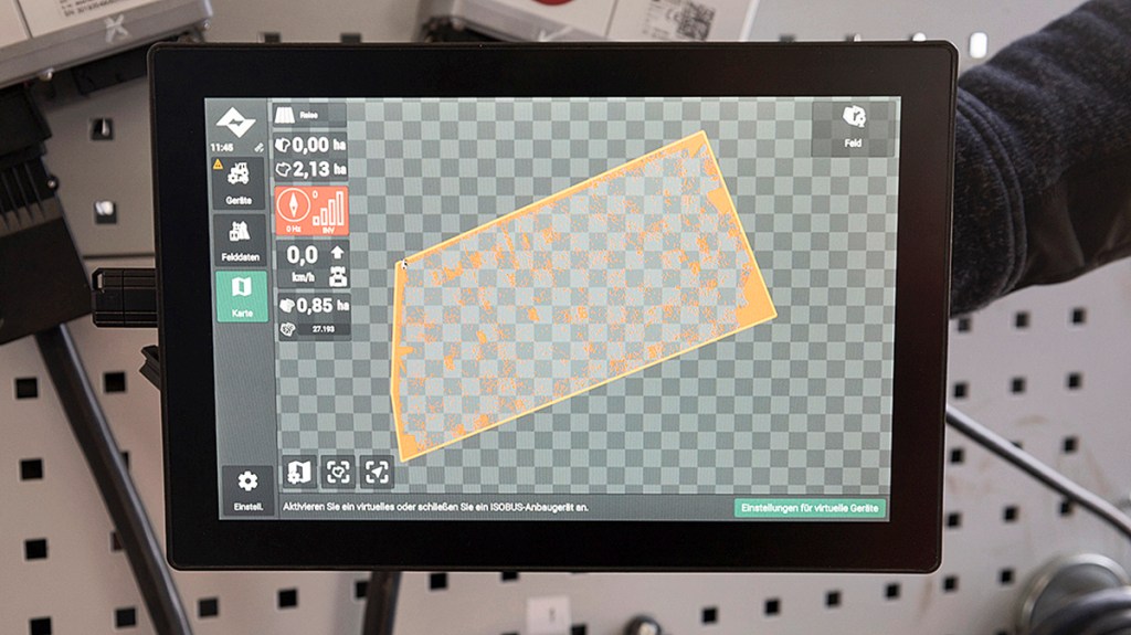
Sam Dimension says that map processing currently takes a maximum of 24 hours. Once the processing is completed, contractors can select the treatment that is to be carried out in the mapped field. This is done on the password-protected portal. Here they can download the digital application maps to the sprayer – formatted to individual terminal requirements – plus a PDF report for the farmer. This report includes an application map and a table showing the herbicide savings potential by adjusting spraying section widths.
Other details:
- The Sam-Cam AI can detect grass weeds within dicotyledonous crop stands. In reverse, it also detects weeds in cereal crops. It doesn’t detect weed species as yet – apart from dock, thistle and volunteer potatoes.
- To fly the drone, which weighs just under 25kg, the pilot needs the ‘small drone licence’ for category Open A3. (CAA registration, Operator ID and Flyer ID in the UK).
- The price for the complete package – including the Multicopter drone, multi-camera rig, RTK-GNSS module, GSM modem, remote control, six batteries and licences – is about €90,000 (£77,000). Those who own a suitable drone and need fewer spare batteries can save about €30,000, (£25,000).
- The cost of a spot-spray mapping job through a contractor varies depending on field size, recipe formulation and region. According to Sam Dimension, it worked out at about €20-45/ha last season (£17-£38).
- Sam Dimension started selling its mapping system last year. Currently, about 15 units are in use across Germany. Contractors offering mapping with Sam Dimension’s multi-camera rig include agricultural machinery dealers as well as individual contracting businesses, cooperatives and machinery rings.
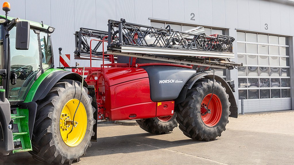
- In June, Horsch announced it had taken a strategic stake in SAM Dimension and has been working on further integrating the technology. It has already been able to work with the created maps for spot- and patch-spraying.
Summary
Sam Dimension’s Sam-Cam AI comes with six cameras and a graphics processor. To map a field, the drone flies at a height of 60m, covering a working width of about 48m. Even at this height, the photos are so high resolution that it possible to distinguish between weeds and crop plants as early as in the cotyledon stage, says the manufacturer.
The system costs between €60,000 and €90,000 (£50,000-£77,000) excl. VAT, depending on whether it is bought with or without a drone from German manufacturer Multikopter. This concept makes the flying job itself a contracting job. Contractors can download the application maps from a portal for a 24-hour period after the drone photos were uploaded.
Anja Böhrnsen
For more up-to-date farming news click here and subscribe now to profi and save.